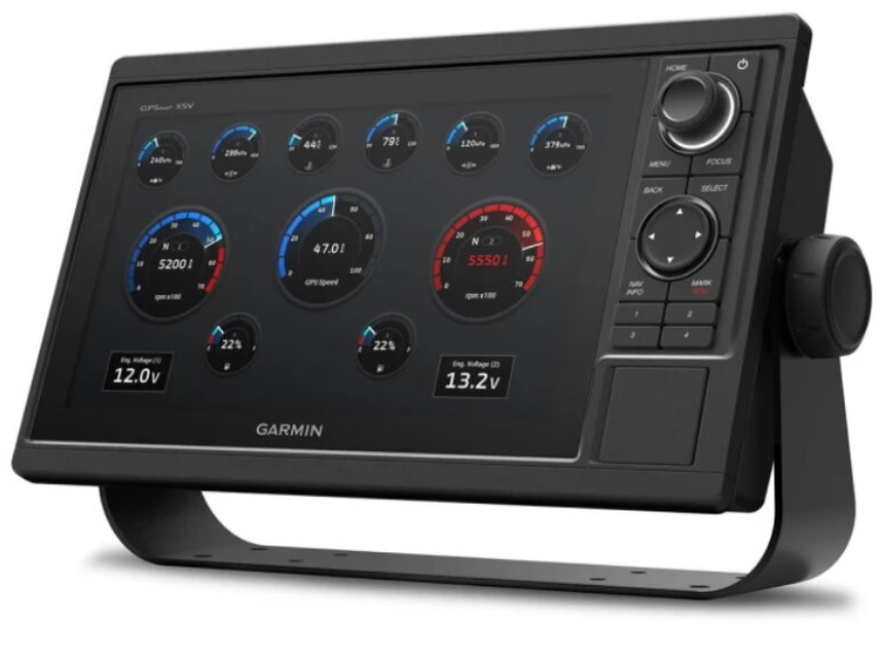
These chartplotters feature large, bright displays and user-friendly keypads with customizable programmable keys and multifunction control buttons, making navigation effortless.
* Enjoy wider viewing angles on vivid 10″ or 12″ color displays.
* Compatible with Garmin premium maps and charts for the best navigation experience.
* Share information between multiple units thanks to Garmin Marine Network compatibility.
* Experience smooth position and heading updates with a 10 Hz refresh rate.
* Easily transfer waypoints, tracks, and routes from other GPS devices.
* View underwater surroundings with integrated sonar functions on selected models (transducers sold separately).
INTEGRATED SONAR FUNCTION
These chartplotters include built-in single-channel CHIRP sonar, plus CHIRP ClearVü™ and CHIRP SideVü™ scanning sonars, as well as compatibility with Panoptix™ and LiveScope™ sonars on selected models (transducers sold separately).
BUILT-IN ANT® CONNECTIVITY
Enjoy wireless ANT connectivity directly with compatible Garmin devices such as quatix® marine watches, gWind™ Wireless 2 transducers, GNX™ Wind instruments, and wireless remotes.
CONNECTED ACTIVECAPTAIN® APP
Built-in Wi-Fi® technology provides access to the free multifunction ActiveCaptain app, allowing you to manage your marine experience from almost anywhere using a compatible smartphone.
GARMIN SAILASSIST™ FUNCTION
Use the polar data chart to view key sailing metrics that help you navigate faster and more efficiently. See laylines, your set and drift, true and apparent wind data (sensor sold separately), and much more.
MAPS AND CHARTS
Give your chartplotter a new look and feel with optional Garmin Navionics+™ or Garmin Navionics Vision+™ premium charts, featuring integrated coastal/inland content, daily updates, Auto Guidance+™¹ technology, and more.
SEAMLESS POSITION TRACKING
The built-in high-speed 10 Hz GPS and GLONASS receiver updates your position and heading 10 times per second, ensuring smooth movement tracking on screen.
NETWORK CONNECTIVITY
GPSMAP chartplotters are fully compatible with the Garmin Marine Network and NMEA 2000®, and can also be used with NMEA 0183 technology.
EASY WAYPOINT TRANSFER
Easily transfer waypoints, tracks, or frequently used routes from other devices using standard GPX software formatting.
FULL NETWORK SHARING
Garmin Marine Network compatibility allows sharing of sonar, maps, user data, radar (dome or open-array), and Panoptix or LiveScope sonars across multiple units.
ENGINE CONNECTIVITY
View RPMs, fuel flow, temperature, trim, and other vital information at a glance. Contact your engine manufacturer for additional hardware requirements.
SEND MESSAGES WITH INREACH® DEVICES
Pair your inReach® satellite communicator with the chartplotter and type custom messages using the on-screen keyboard of the multifunction display. Access your contact list or enter an email, inReach address, or phone number. You can also group messages by conversation for a chat-like experience.
SHALLOW WATER ANCHOR CONTROL – POWER-POLE®
By networking compatible Garmin chartplotters with a Force® trolling motor and a compatible Power-Pole shallow-water anchoring system, you can access advanced vessel control features directly from the plotter—such as smart anchoring, smart push, auto stow, anchor drag detection, and Auto Guidance+¹ anchoring at the end of a route. More fishing time, less boat positioning time.
POWER-POLE CHARGE INTEGRATION
Your Power-Pole CHARGE marine power management system integrates with compatible Garmin chartplotters to help maintain battery charge while on the water. You can charge batteries on the go, monitor power usage, control power distribution, perform emergency starts, and even transfer power between batteries—all directly from your chartplotter display.
¹ Auto Guidance is for planning purposes only and does not replace safe navigation operations.
² An active satellite subscription is required. Some jurisdictions regulate or prohibit satellite communication devices. It is the user’s responsibility to comply with applicable laws.
³ Integration requires purchase of a C-Monster GATEWAY from Power-Pole.
FEATURES AND PERFORMANCE:
*Physical dimensions: 31.8 × 18.5 × 6.9 cm
*Weight: 1.85 kg
*Water rating: IPX7
*Display type: WSVGA, NP
*Display size: 22.4 × 12.5 cm; 10.1" (25.7 cm) diagonal
*Display resolution: 1024 × 600 pixels
*Mounting options: bail or flush
*Key assist buttons: yes
Maps and Memory:
*Data card support: yes (2 microSD slots)
*Waypoints: 5,000
*Track points: 50,000
*Saved tracks: 50
*Routes: 100
Sensors:
*GPS
*GLONASS
*Built-in receiver: yes (10 Hz)
*NMEA 2000 compatible
*NMEA 0183 compatible
*WAAS enabled
Integrated Maps:
*Tide tables
Optional Chart Support:
*BlueChart g3
*BlueChart g3 Vision
*LakeVü g3
*LakeVü g3 Ultra
*Garmin Navionics+™
*Garmin Navionics Vision+™
*TOPO 100K
*Standard maps
*Garmin Quickdraw Contours
*Raster map support
Chartplotter Features:
*Smart Mode compatible
*AIS support
*DSC support
*Fusion-Link™ compatible
*GSD and GCV Black Box Sonar support
*ActiveCaptain® compatible
*GRID (Garmin Remote Input Device) compatible
*Wireless remote compatible
Electrical:
*Power input: 10–32 V DC
*Typical current draw at 12 V DC: 1.9 A
*Maximum current draw at 12 V DC: 2.7 A
*Maximum power consumption at 10 V DC: 32.4 W
Sonar Features and Specifications:
*Sonar display supported
*Traditional sonar (dual frequency/beam): yes (with external black box, sold separately)
*ClearVü: yes (with external black box, sold separately)
*SideVü: yes (with external black box, sold separately)
*Panoptix™ sonar support
*LiveScope™ support
Connections:
*NMEA 2000® ports: 1
*NMEA 0183 input (Rx) ports: 1
*NMEA 0183 output (Tx) ports: 1
*Video input ports: 1 (BNC composite)
*Garmin Marine Network™ ports: 2
*Bluetooth® connectivity
*ANT® connectivity
*Garmin Wi-Fi® network (local connection)